We Continue to Head For Home
(June 7, 2009) From Susanville, CA we followed Highway 89 around Lassen National Park.


Before long, we came to beautiful Burney Falls State Park. I had been there over 30 years ago and remembered that it was a beautiful area but seeing it once again I realized it was more lovely than I remembered.
There’s a very nice campground here. Along with camping cabins, a store and gift shop, bathrooms and showers. Lake Britton is also in the park and there you can launch your own boat or reserve one of the park’s boat to use during your stay. There are lots of hiking trails in many different lengths and degrees of difficulty. I hope we can go back there one day and camp for a few days…it’s truly a beautiful place.


Can you see the critter in the picture below? They were running all over the hillside above the falls.

After leaving Burney State Park we continued in a north westerly direction towards I-5. We hadn’t gone too far when we passed this unusual looking tree. We were so curious Bob turned around and went back to get a closer look. There was a huge gravel area around the tree and it was obvious that there has been lots of cars coming and going from there.


Hundreds of pair of shoes and slippers were hanging from this tree. It was certainly a curious sight and no where in the area was there any explanation.
We stopped in Weed, California for some lunch. Weed sits in the shadow of Mt Shasta and I was happy to get some pictures of it without being in a moving vehicle.


After lunch we soon crossed into Oregon veering back to the east and Highway 97. We were heading for Klamath Falls, Oregon. Klamath Falls is a lovely city that sits at 4, 120 feet above sea level, I wish we could have spent more time there. We did pass by Klamath Lake…20 miles long and in most places only 15 feet deep. Our destination goal today was Crater Lake. However it was getting late and we couldn’t find a reasonably priced campground. So we ended up back in Klamath Falls spending the night in the far corner of their Fred Meyer parking lot.
(June 8, 2009) After stocking up on milk and some other groceries we head for Crater Lake National Park. It’s about a 60 mile drive from Klamath Falls and as you climb to over 6,100 feet the scenery is breathtaking! Here it was June and there was still snow along the edges of the road.


This is the explanation of “Fossil Fumaroles” I was able to find on Google.
“ The history of the strange rock formations in
front of you began about 7,700 years ago
when the eruptions of Mt. Mazama were reaching
their climax. Torrents of red-hot, gas-charged
pumice poured down Mazama's slopes at speeds
of up to 100 mph (160kph). On top of this came
a flow of heavier rocks called scoria. These
glowing avalanches flooded down slope for many
miles, leaving deep deposits in their wake.
Temperatures in the deposits may have
exceeded 750 F (400 C). Plumes of vapors
appeared, as gasses escaped from the settling
rocks through vents called fumaroles. Minerals
in the gasses, combined with extreme heat,
welded the sides of the fumaroles in the shape
of slender cones. Since then, Annie Creek has
eroded a canyon through the deposits, exposing
the foxxil fumaroles as pinnacles and columns.
The depth of the canyon here at Godfrey Glen
is about 250 feet (75m).”

As we neared Crater Lake there was more snow.

And we’re here! Crater Lake was formed over 7,000 years ago with the collapse of Mt Mazama. At 1,949 feet~it is the deepest lake in the United States. and ranks 7th in the world. The level remains pretty much the same all year because it’s fed by rain and snow and only drops during the summer months due to evaporation.

The island is called Wizard Island and there is a boat landing out there for tour boats.

Crater Lake is 6 miles across and 20 miles around the rim. We went part of the way around but some of the road was still closed due to their heavy snowfall last winter.

Their gift shop, rest rooms and snack bar are located in this building. There’s a penny squishing machine in there. The curious watched me squish some pennies and when they saw the Crater Lake penny, several went to get change which included quarters and shiny pennies.


The snow and the mountains in the distance were so pretty. After being in the desert it was quite a change.


As we head down from Crater Lake we are treated to different views.


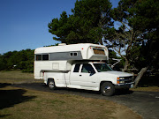
At this turn-out we climbed up several flights of wide stairs to look at the lake as we turned to head down ~ there was the truck and camper.

There was a person on the hill below, climbing presumably up to the fire look out on the top.

Out of Cater Lake National Park we go….

22 miles south of Bend, Oregon we pulled into La Pine Oregon State Campground. All Of Oregon’s state parks are great to camp in….they are very well maintained and laid out nicely. We had two visitors at this campground. Our first one was this little guy.

He was very brave and in the picture below, he was just a few feet from where Bob was eating pistachios.

Our second visitor(s) were hundreds of mosquitoes. After we got dinner cooked, we actually had to retreat into the camper. For some reason we left home with no repellent ….not a good thing to do. (That’s been taken care of~believe me)
(June 9, 2009) We were up and leaving the campground about 9:45am. I was excited because I knew that tonight I’d be sleeping in my own bed. But when we came to Bend, Oregon we had to stop. We both love Bend and after a visit to their Goodwill and the Outlet stores we pulled into the Black Bear Diner for some lunch.

If you have a Black Bear Diner near you, I highly recommend you stop by and check it out. The decor is so cute and the food is delish!

After some shopping and some eating we continue north on Highway 97 and then west on Highway 27. With Mt Hood barely visible in the distance…we crossed a mountain pass in a storm…thunder, lightening, heavy rain and hail. It was so scary…and of course those who are familiar with the road did not slow down. Talk about a “white knuckle” ride !

When we got over the pass, Bob pulled into a Dairy Queen where we had to have a Peanut Buster Parfait to calm our nerves.

We eventually came to Interstate 5 and crossed the mighty Columbia River into Washington state at 6:05pm.
Up I-5 we went, pulling into the driveway at 8:30pm. We’d been gone 29 days and traveled 3,079.3 miles. Safe at home again.
Thank you all so much for coming along on this road trip.
We took a short 5 day road trip on Washington’s Olympic Peninsula in August….I’ll be posting those entries in the future.


((((((((((((((((((((HUGSTOYOU)))))))))))))))Very nice.have a nie Happy Holiday weekend.
ReplyDeleteThe falls are gorgeous!
ReplyDeleteWe've been to Crater Lake and also found it beautiful and fascinating. (I think we were there in June, too, and also encountered snow. Brrr!) We were intrigued by the intense blue of the lake, and learned that it was due to the clarity and depth of the water. The other colors of the spectrum are filtered and absorbed by the water, but the blue is reflected. It's an amazing effect!
great trip thanks for sharing
ReplyDeletehttp://en.wikipedia.org/wiki/Shoe_tossing
ReplyDeletethis might help explain the shoe tossing..lo
Melanie
All your pictures from your whole trip are so beautiful!!! That Burney Lake sounds familiar, I may have been there on one of our family trips in my teens... and snow!! It so amazes me how we can just drive from one extreme weather to the next so close together.... 110 degree temps to snow....
ReplyDeleteHappy Labor Day!! :)
Love them all. Glad you got the opportunity to do all that sight-seeing. I am so jealous. Have a good week. nancy
ReplyDeleteI wouold be up to hiking that Falls Loop Trail any time you're ready.
ReplyDeleteD
Beautiful. We went by there on one of our tips to WA. I swear we spent the night there but Richard says we didn't. His memory IS better than mine-but hardly foolproof. LOL
ReplyDeleteWonderful photos. Just beautiful. And so interesting. thanks for sharing.
Hugs, Barb
The photos are gorgeous Linda! Sorry I'm late getting over, too much time at work!I loved MT Shasta and that dear little chipmunk! Glad you had a good time! Jeannette xx
ReplyDeleteWow...what beautiful scenery Linda, it reminds me our trip to the Canadian Rockies last year. How I long to go back there, it was that wonderful. I`m so glad you had a such a good trip and I hope you can go back to that campsite and spend some time there. I wonder if the shoe tree was started by a single person throwing an old pair of shoes away. Then maybe someone else decided to add a a pair and now the more there are the more people are tempted to leave their own souveniers...lol!
ReplyDeleteLove Sandra xxxx